Everything you need to know about one of the most protected stretches of freshwater shoreline in the world. Communities, beaches, seasons, lighthouses, fishing, and what it actually feels like to belong here.
My family had a summer home on the Platte River in Honor when I was growing up. I've been coming Up North for 47 summers, and I've been bringing my own kids here for 16 years. I know what the light looks like at 7pm on the river in August. I know M22 in spring when the beech forest is just leafing out pale green, and I know it in October when the sugar maples and beech trees go red and gold and the drive becomes something you don't rush. That's not a pitch. It's just the reason I take this area seriously in a way that goes beyond market data.
Sleeping Bear Dunes National Lakeshore is federally protected land. What that means for anyone considering a second home in the corridor: the surrounding communities will not sprawl, the dunes will not be developed, and the natural character of the area is locked in. You are buying into a finite thing.
That protection, combined with Lake Michigan's moderating microclimate, limited inventory, and growing national attention as a climate-resilient destination, has created a second-home market that behaves differently from most. Properties here don't chase national trends. They tend to hold value and appreciate steadily, with occasional sharp moves when the Lakeshore lands on another national list.
This guide covers the communities, the beaches, where to stay while you're looking, and what the area is actually like in every season. If you're thinking about buying Up North, this is where I start every conversation.
The Ojibwe people who lived along this shore for centuries carried the story with them. A mother bear and her two cubs fled a great forest fire in Wisconsin. They crossed Lake Michigan together, swimming through open water toward the far shore.
The mother reached land. She climbed the bluff and lay down at the water's edge to wait for her cubs. She waited so long, and with such devotion, that the sand slowly drifted over her and she became part of the dune.
The Great Spirit, honoring her love, raised the cubs from the lake as islands. North Manitou Island and South Manitou Island. They sit there now, visible from the bluff on a clear day, watching over her still.
That dune ridge, where the mother bear rests, is Sleeping Bear Dunes. The Lakeshore takes its name from her.
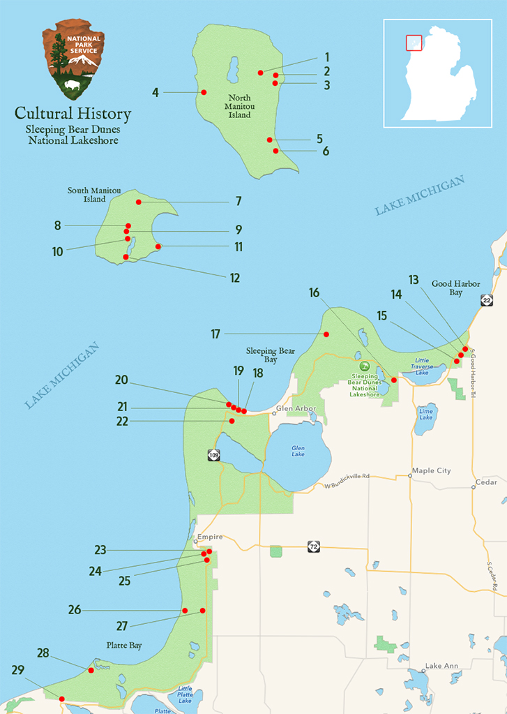
15,000 acres of designated wilderness. No roads, no stores, no services. Primitive camping only. Ferry access from Leland via Manitou Island Transit (seasonal). The island draws backpackers who want the National Lakeshore completely to themselves. There are old farming homesteads and forests growing back over what was once cleared land.
Smaller and more visited than North Manitou. The South Manitou Island Lighthouse (built 1872, deactivated 1958) stands 100 feet tall and is one of the most iconic structures in the Lakeshore. NPS rangers lead tours to the top in summer. The Francisco Morazan shipwreck, grounded offshore in 1960, is visible from the beach. A valley of old-growth white cedar trees, some over 500 years old, survives in the interior.
Ferry from Leland, 1.5 hours each way. Day trips and camping available. Manitou Island Transit: (231) 256-9061.
The Sleeping Bear story doesn't begin with the 1970 National Lakeshore designation. The Anishinaabe people, and specifically the Odawa and Ojibwe of what is now the Grand Traverse Band of Ottawa and Chippewa Indians, lived along this shoreline for centuries. The legend is theirs. The word Manitou comes from their language, meaning spirit.
The Grand Traverse Band is a federally recognized tribe, headquartered in Peshawbestown on the Leelanau Peninsula. Their Eyaawing Museum and Cultural Center is there. It's a genuinely good place to spend an hour if you're in the corridor.
Knowing who was here before is part of knowing where you are. This place has a long memory.
Each community along the Sleeping Bear corridor has its own character, price range, and draw. Here's the honest breakdown on what makes each one different, so you can find the fit that actually makes sense for you.
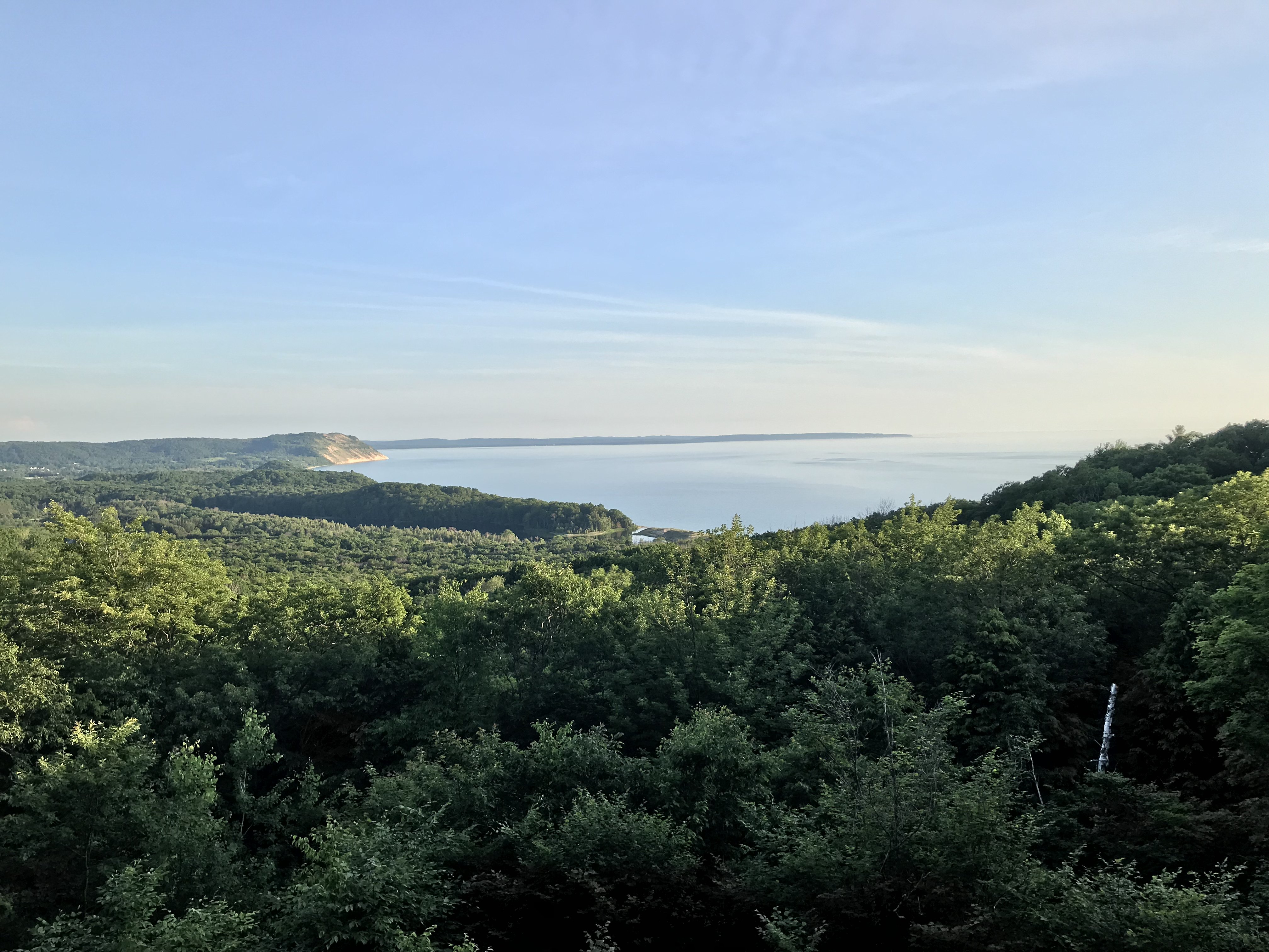
Empire sits right at the park entrance. The famous Dune Overlook is a short drive, and Empire Beach is one of the most photographed spots on Lake Michigan. The village is small and intentional. When something comes on the market here, it tends to move.
Good fit for buyers who want maximum proximity to the park and don't need a large downtown. Inventory is limited and the appreciation trend has been consistent.
Glen Arbor is the highest-demand address in the corridor. Glen Lake sits behind the dunes and has an extraordinary clarity. The village has galleries, restaurants, and a loyal second-home community that's been buying here for decades.
The Glen Arbor Arts Center runs programming through the summer. Median prices jumped 41% in 2025. Buyers here are paying for the lake and the place in equal measure.
Platte Lake feeds directly into the Platte River, which runs through the National Lakeshore and empties into Lake Michigan. That river access makes Honor a draw for fishing, kayaking, and the iconic Riverside Canoes float. The vibe here is authentically local.
Less discovered than Glen Arbor or Frankfort, with noticeably better value per dollar compared to its neighbors. Worth a serious look for buyers who want park access without the premium price tag.
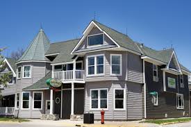
Frankfort has infrastructure the smaller villages don't: a proper downtown, the historic Hotel Frankfort, the Garden Theater, local restaurants, a marina, and a working harbor on Betsie Bay. It feels like a town, not just a seasonal cluster.
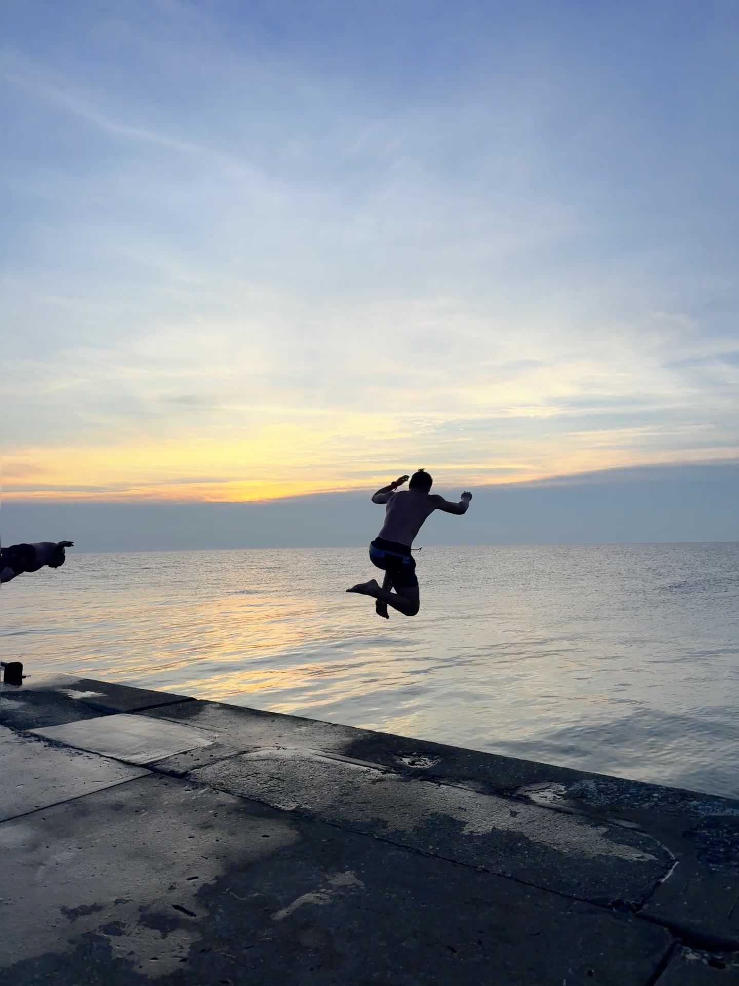
The north pier reaches out into Lake Michigan with a bright red lighthouse at the end of the breakwater. Jumping from the end of that pier at sunset is a local rite of passage, the kind of thing that becomes family legend. People who've done it don't forget it.
Good fit for buyers who want walkability and year-round access to services alongside the beach. Crystal Mountain Resort is nearby for winter. Hotel Frankfort is two blocks from the water.
Fishtown is Leland's signature: a cluster of early 1900s fish shanties now housing galleries, smoke shops, and small restaurants along the Leland River. The Old Art Building hosts live music and programming all summer. Good Harbor Beach is nearby.
Leland attracts buyers who want natural landscape alongside genuine arts and community character. Lake Leelanau waterfront properties carry some of the highest per-square-foot prices in the county, and they move.
Beulah sits on Crystal Lake, a 9,800-acre lake known for exceptional clarity and water quality. The town is quieter than most of the corridor's gateway communities, which is the draw for a specific kind of buyer.
Good value relative to Glen Arbor, with access to Crystal Mountain for winter skiing and hiking. Worth a look if you want serious lake frontage at a more accessible price point than the Leelanau side.
Two Beulah stops worth knowing: Cherry Hut, a local institution since 1922 serving cherry pies and fresh cherry products on US-31, and Cherry Bowl Drive-In, one of the last operating drive-in theaters in Michigan. Both are exactly what they sound like, and both are better than they need to be.
The Sleeping Bear corridor has some of the best freshwater beaches in North America. Below is what you actually need to know before you go: dogs, fires, and what makes each spot worth the drive.
The postcard beach of the corridor. Sits right at the edge of the village of Empire, with the dune ridge visible from the water. Wide, sandy, and oriented perfectly for sunset watching. Part of the beach area falls within NPS jurisdiction.
Found at the mouth of warm Otter Creek. Less trafficked than Empire Beach, with a more tucked-in feel. The creek makes for a calm wading area alongside the open lake access. One of the corridor's most reliable finds for a quieter afternoon.
One of the most beautiful and genuinely secluded beaches in the entire Lakeshore. At the end of a gravel road, which keeps the crowds manageable. A great place to hide out on a hot summer afternoon without the parking lot scene at other access points.
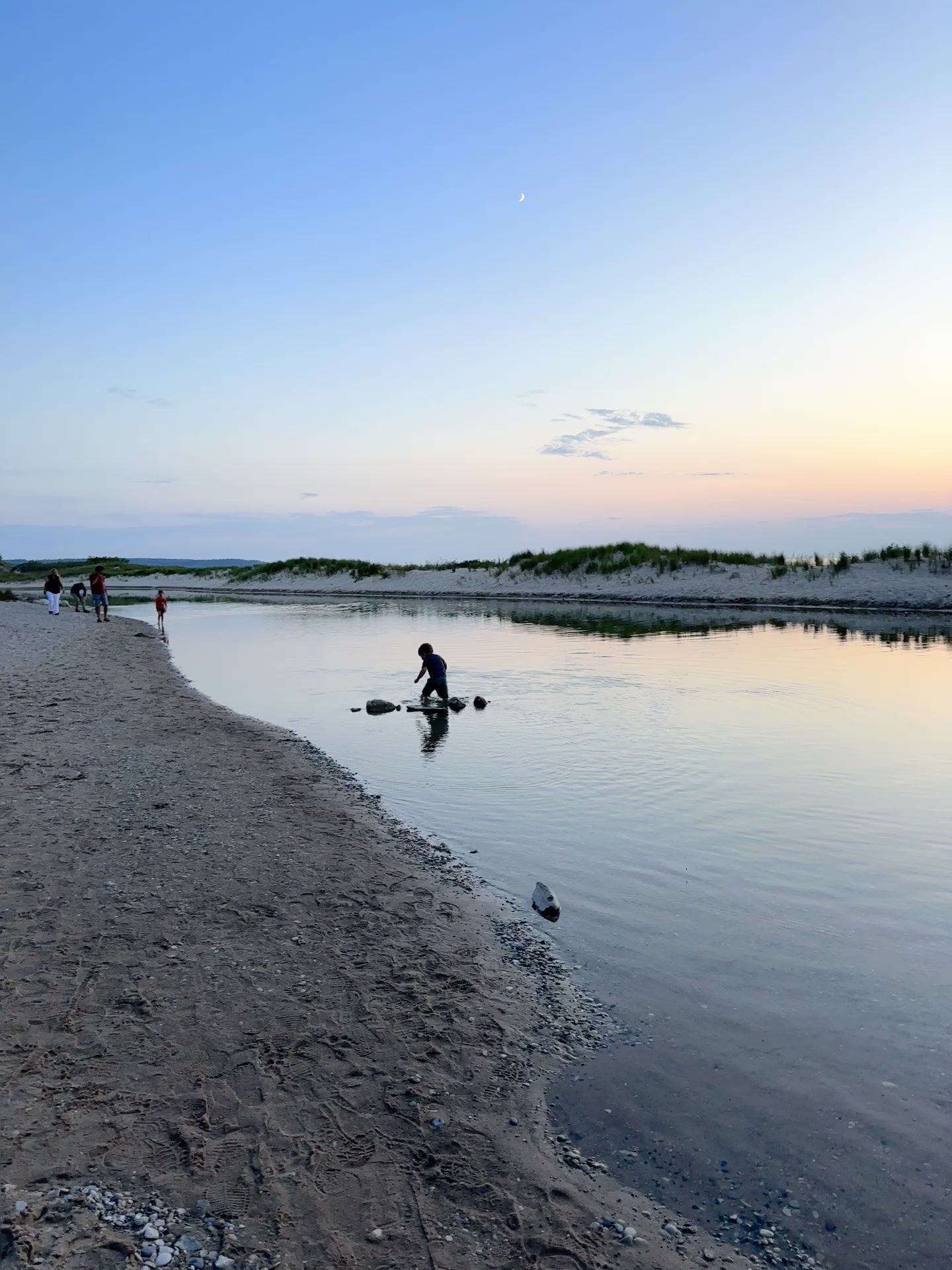
Where the Platte River flows into Lake Michigan. Popular with swimmers, tubers finishing the Riverside Canoes float, and anyone who wants the novelty of standing where fresh river water mixes with the lake. Expect company on summer weekends.
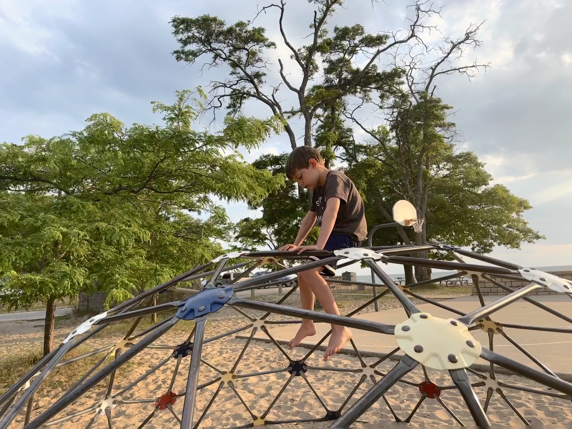
A historic beach area adjacent to the Glen Haven village and Maritime Museum. Offers a playground, lighthouse views, fire rings, and a picnic area. The beach east of the Maritime Museum is open to leashed dogs. The west section has seasonal restrictions.
Two separate access points along CR 651 and CR 669. Both allow leashed dogs year-round, which makes Good Harbor one of the most practical options for pet owners in the corridor. Wide sand, clear water, and typically less congested than the beaches closer to Empire.
These aren't local chamber of commerce participation awards. Good Morning America. National Geographic. TripAdvisor. Sleeping Bear has been on the world's short list for a while now.
100,000 viewers voted online. Sleeping Bear Dunes won with 22% of the vote, edging out Aspen, Colorado and Lanikai Beach, Hawaii. That result landed this stretch of coastline on national radar in a way that still drives interest more than a decade later.
National Geographic placed Sleeping Bear Point on its global Top Beaches list in the "dune walkers" category, citing the 450-foot bluffs, Lake Michigan views, and Sleeping Bear Point Trail. Not a regional honor. An international one.
In the "One-of-a-Kind Beaches" category, Sleeping Bear Dunes ranked fourth worldwide. The only U.S. entry on the list. The three beaches ahead of it were in South Africa, Italy, and the UK. Out of 8 million listings on the platform, fewer than 1% reach this level.
M-22 runs 116 miles along the western edge of the Leelanau and Benzie coastline. USA Today named it the best autumn drive in the country, and anyone who has done it in October understands why. The route passes through Leland, Glen Arbor, Empire, Frankfort, and Beulah, with Lake Michigan on one side and color-saturated forest on the other.
The 7.4-mile one-way loop inside the National Lakeshore draws over 80,000 visitors a year. Twelve named overlooks, including the Lake Michigan Overlook at 450 feet above the water. Pierce Stocking, a lumberman who fell in love with the dunes, built the original road himself in 1967 and opened it to the public before the NPS acquired it. It was recognized as part of the GMA "Most Beautiful Place in America" national footprint.
The Lake Michigan shoreline was one of the most dangerous stretches of water in North America for 19th-century shipping. These lighthouses weren't built for tourists. But they're extraordinary places to visit now.
The most photographed lighthouse in Michigan. It sits at the tip of a narrow sand spit where Betsie Bay meets Lake Michigan, painted white and red and completely surrounded by water on three sides. Still fully operational, with the original Fresnel lens on display inside.
The Betsie Bay area is also where the lake-effect snow machine really runs in winter, and the lighthouse in ice conditions is genuinely dramatic. Guided tours available seasonally through the Point Betsie Lighthouse Preservation Society.
6 miles north of Frankfort on Pointe Betsie Rd. The beach around it is open and public.
100 feet tall. Deactivated in 1958 after over 80 years of continuous operation. You have to earn this one: ferry from Leland (1.5 hours each way), then a walk through the island to reach it. NPS rangers lead tours to the top in summer. The view from the lantern room covers the lake in every direction.
While you're there: the Francisco Morazan, a 246-foot cargo ship that ran aground in 1960, is still visible offshore from the beach. And the old-growth white cedar forest on the south end of the island has trees over 500 years old.
Ferry via Manitou Island Transit: (231) 256-9061. Seasonal schedule only.
Not exactly a lighthouse, but part of the same story. The U.S. Life-Saving Service stationed crews here to rescue sailors from the notoriously dangerous shoals off Sleeping Bear Point. The station is now the Maritime Museum, run by the NPS, and it's genuinely fascinating: surfboats, breeches buoy equipment, and the full story of what it took to work this coastline before GPS or radar.
The adjacent Glen Haven village, also preserved by the NPS, includes the original general store and blacksmith shop, both largely intact from the late 1800s. The Glen Haven Canning Company — which processed cherries, raspberries, and peaches for Great Lakes markets — is now the Cannery Boat Museum.

Photo: National Park Service
Glen Haven village, off M-109 near Glen Arbor. Free. Open seasonally.
A bright red cylinder at the end of Frankfort's north pier, sitting where Betsie Bay meets Lake Michigan. You walk the full length of the breakwater to reach it, with open water on both sides and the town behind you. The walk itself is the draw. On a clear evening, the light and the lake and the last of the sun all arrive at the same time.
The pier is also where the local jump tradition lives. Clearing the end of the pier into Lake Michigan is a rite of passage for anyone who grows up spending summers here, or wants to. The water is deep, the view is long, and the drop is enough to matter.
Off Main Street, Frankfort. Pier is open and free. Best at golden hour.
If you spend any time in Honor, someone will tell you about Riverside Canoes. They've been running the Platte River for years, and the float from the Weir to Lake Michigan is one of those experiences that is harder to explain than it is to do.
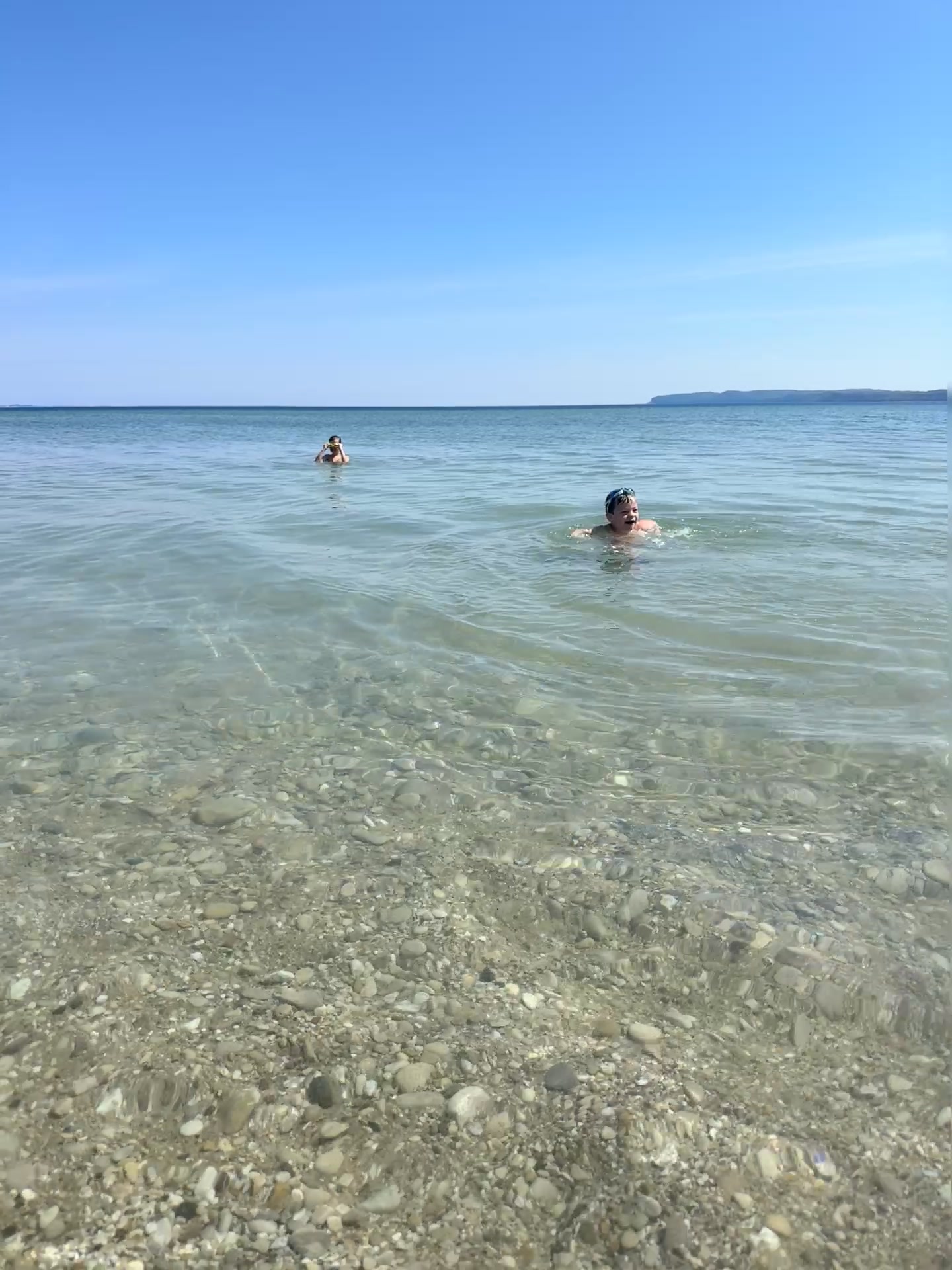
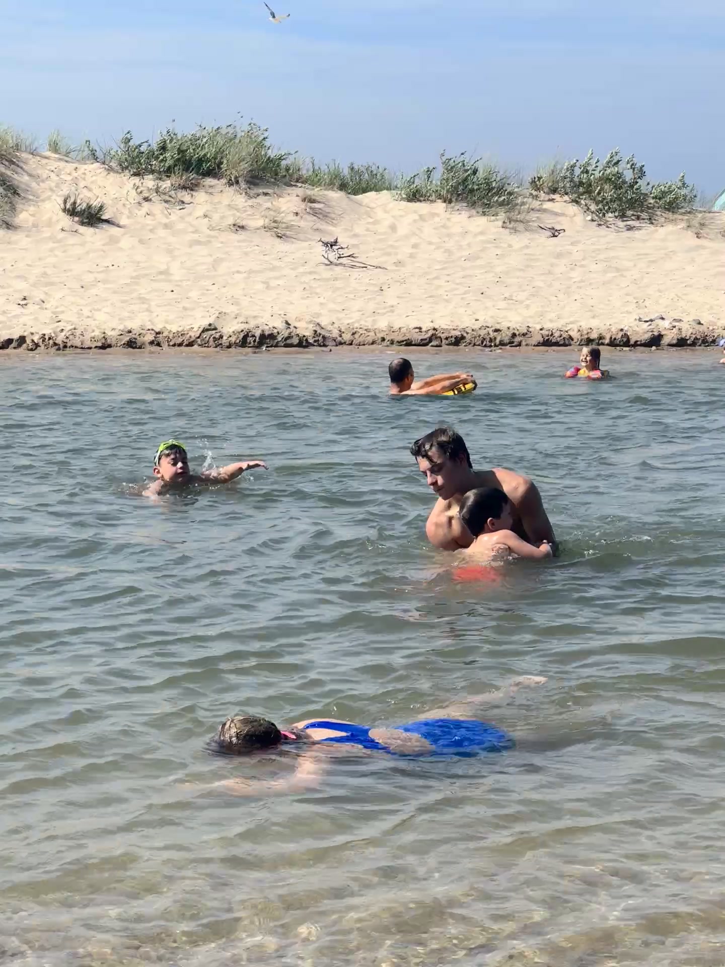
You tube through woods and open stretches of the Platte, the water runs clear and warm enough to swim comfortably all summer (mid-60s to low 70s in July and August), and you end up popping out at the beach where the river meets Lake Michigan. It takes two to three hours at a relaxed pace. There is no bad version of this trip.
They also run shorter trips (the Loon and Walk is about an hour), canoes, kayaks, and two-person kayaks. Reservations are smart in summer. The number is below and they respond quickly.
Note: Riverside Canoes is right down the road from the Sleeping Bear Gem on Lower Platte AirBnB (see Where to Stay). The timing works out almost perfectly for a morning float and an afternoon on the dock.
The Platte River isn't just a float trip. It's where Michigan's salmon fishery started. In 1966, the Michigan DNR stocked the very first Coho salmon ever planted in the Great Lakes into this river. The experiment worked. The run that returned the following fall was the proof of concept that transformed Great Lakes fishing for good. Today, the Platte River State Fish Hatchery near Honor is the main source of Michigan's salmon stocking, supplying eggs to Indiana, Illinois, and Wisconsin as well. Nearly 6 million Coho eggs are collected here in a single fall season.
Around 18,000 to 20,000 adult Coho salmon pass through the Platte River weir each fall, counted by DNR biologists. In big run years, that number has exceeded 140,000 fish. The weir itself, just off Honor Highway, is publicly accessible and worth seeing during the September run.
The fall run — mid-August through September for Coho, with Lake Trout active June through August in Platte Bay — draws anglers from across the Midwest. The river is accessible on foot, and charter fishing in Platte Bay is available out of Frankfort and Honor.
Peak jigging window in Platte Bay. The Platte River run typically follows 2–3 weeks later.
Present in Platte Bay. Vertical jigging from charter boats. Excellent catch rates through summer.
Spring run in the Platte and nearby rivers. Cold water, high fish activity. A separate and excellent season.
The Platte River was one of two rivers used for the first Great Lakes Coho stocking. Michigan's entire salmon fishery traces back here.
The Platte is spring-fed, which keeps it naturally cooler and clearer than most Michigan rivers. Perfect for floating in summer. Perfect for salmon in fall.
Approximate averages based on spring-fed river conditions. Temperatures vary by flow and season. Always check conditions before fishing.
A few places worth knowing about when you're scouting the area. The corridor has more options than you'd expect, ranging from full resort experiences to small B&Bs walking distance from the dunes.
The highest-end option in the corridor. The Inn overlooks the Crystal River where it winds toward Lake Michigan, with views of the dunes and the lake from the rooms. Suites have fireplaces and kitchens. Beach club, pool, spa, clay courts.
Built in 1866, the Sleeping Bear Inn is the oldest operating inn located inside a National Park in the United States — predating Yellowstone. Listed on the National Register of Historic Places since 1985. A full breakfast is served each morning using locally sourced ingredients. Rooms overlook the lake or the back dune.
Seventeen rooms in a historic downtown building, two blocks from Lake Michigan. Walking distance to the Garden Theater, local restaurants, galleries, and the Betsie Bay harbor. Each room is individually decorated, ranging from simple to full luxury.
A three-generation family cottage on the Lower Platte River in Honor, fully renovated and available year-round. Five bedrooms, private dock, fire pit, and direct access to the river for tubing, kayaking, and fishing. Riverside Canoes is just down M22.
My sister and I bought this property from our family, who have owned this stretch of the Platte River since 1970. When I say I know the area, this is part of what that means. We renovated the cottage to be something you'd actually want to stay in for a full week rather than just a long weekend.
If you're using a stay here to explore the corridor for a potential second home purchase, reach out before you book. I'm happy to talk through what you're looking for and what the market is doing before you even arrive.
Most people think of this area as a summer destination. The buyers who own property here tell a different story. The dunes covered in snow, the Heritage Trail on cross-country skis, ice fishing on a frozen inland lake, and a fire on the beach in February when you have the whole stretch to yourself. If a second home is only useful four months of the year, run the math again.
Snowshoeing is permitted across all snow-covered dunes, fields, and forests in the Lakeshore. Self-guided ranger hikes run every Saturday from 10am to 3pm through the winter months. The dunes look completely different under snow.
The Sleeping Bear Heritage Trail runs 20 miles between Empire and Bohemian Road. Good Harbor Bay Trail (2.8 miles) and Platte Plains Trail (14+ miles) are two of the flattest routes in the Lakeshore. Equipment rentals are available locally.
Twenty-one lakes within the Lakeshore hold salmon, bass, pike, and perch. Once temperatures drop consistently, shelters go up and fishing starts through the ice. The park runs youth ice fishing events in February if you want an introduction.
Crystal Mountain Resort is roughly 20 minutes from Frankfort. Downhill skiing, cross-country trails, a spa, and lodging. Good option for buyers considering the Frankfort or Beulah side of the corridor who want winter resort access.
This is not a talking point. It's a set of structural facts that anyone buying property in a climate-exposed region should understand, and that anyone buying in the Great Lakes corridor should know works in their favor. The argument isn't complicated: access to freshwater, a moderating microclimate, federally protected land that can't be developed, and a location that becomes relatively more attractive as other regions face heat, drought, and sea level risk.
The Great Lakes hold roughly 20% of the world's surface freshwater. In a warming world where water access is an increasing constraint, this is a durable asset. Michigan's position in this system is a long-term desirability driver that no developer can create or replicate.
Sleeping Bear Dunes National Lakeshore protects more than 71,000 acres from development. That boundary is permanent. It means the natural character of the corridor is locked in, supply of nearby properties is inherently capped, and the area can't be transformed by a large developer at any price.
Lake Michigan keeps the Lower Peninsula measurably warmer than comparable latitudes inland, and moderates summer temperatures in the other direction. This microclimate is why the Leelanau Peninsula produces tart cherries and wine grapes. It also means winters here are more livable than the raw numbers suggest.
Leelanau County recorded 375 closings in 2025 with limited inventory continuing to drive appreciation. Glen Arbor's median hit approximately $592K, up 41% year over year. This isn't a bubble dynamic. It's a supply-constrained market with durable demand drivers.
Grand Rapids continues to attract population from larger metros. Sleeping Bear is a reasonable drive for a weekend, close enough to be a practical second home rather than a once-a-year destination. That proximity to a growing feeder city is a sustained demand driver.
Climate researchers have repeatedly identified the Great Lakes region as one of the most resilient parts of the US for long-term habitability. As coastal and Sun Belt markets face heat, drought, flooding, and insurance cost escalation, the relative appeal of northern freshwater destinations increases.
Approximate averages. Lake Michigan's thermal effect keeps summer highs moderate and winter lows milder than comparable inland latitudes.
Average daily highs. Benzie County / Empire area. Lake Michigan effect keeps summer peaks moderate and extends the shoulder season on both ends.
Market data sourced from Leelanau County recorded closings (2025), Oltersdorf Realty, and the Council of the Great Lakes Region. Climate figures from NPS and GLISA (Great Lakes Integrated Sciences and Assessments). Past appreciation is not a guarantee of future performance. Real estate decisions should be evaluated based on your full financial picture. Reach out to Adrianna Berlin directly. If the timing's off, she'll tell you.
Benzie, Grand Traverse, and Leelanau counties have each more than doubled in median price since 2015. The reasons are structural, not cyclical: federally protected land that cannot be developed, a finite inventory of lakefront and near-park properties, and increasing national attention as a destination. This market doesn't behave like a vacation fad.
All three counties have more than doubled since 2015. Benzie's 144% gain is the highest, driven partly by buyers priced out of Leelanau moving south. The appreciation pattern here isn't driven by speculation. It's driven by supply constraints that aren't going away: NPS protected land, limited buildable lots, and a national profile that keeps growing. The inventory question isn't whether this market will stay valuable. It's whether there will be anything left to buy.
Sources: Oltersdorf Realty (Leelanau County historical data), Michigan Association of Realtors, Northwest Michigan Association of Realtors. Median sale price, all property types. Approximate figures; individual community prices vary significantly from county medians.
The Sleeping Bear corridor sits roughly at the top of the Leelanau and Benzie peninsulas in northwest Michigan. Here's the honest logistics picture from the major departure points.
285 miles via I-196 north. Straight shot up the western Michigan coastline. Or take the Lake Express high-speed ferry from Milwaukee to Muskegon (2.5 hours on the water, see below), then 2 hours north from Muskegon to Sleeping Bear. The ferry adds perspective.
270 miles via US-131 north to M-115. The most direct route crosses the state through Cadillac and then northwest into Benzie County. Or fly into GRR and drive north from there.
Gerald R. Ford International Airport (Grand Rapids) sits 110 miles south. USA Today named GRR the Best Small Airport in the US in 2025. Direct flights from Chicago, Atlanta, Dallas, Denver, New York, D.C., and more. Rent a car and you're at the park before dinner.
Cherry Capital Airport (Traverse City) is the closest commercial airport to the corridor. About 45 minutes from Beulah. Smaller than GRR with fewer direct routes, but Delta and American fly in from Detroit, Chicago, and select hubs. Worth checking fares before defaulting to GRR.
Cross at the Windsor-Detroit tunnel or Ambassador Bridge, pick up I-94 west to US-131 north. The route passes through Grand Rapids, then northwest to the corridor. Canadian buyers are a real segment of this market, particularly Toronto-area and Ontario families.
Madison to Sleeping Bear is about 340 miles via Chicago. Or take the scenic route: drive to Milwaukee and catch the Lake Express high-speed car ferry to Muskegon (2.5 hours), then 2 hours north. Arrives refreshed. The ferry runs May through October.
High-speed catamaran, takes vehicles. Runs from early May through late October. Leaves Milwaukee at multiple departure times daily. If you're coming from Wisconsin or the Chicago area and have never done it, do it at least once. Muskegon is 2 hours south of Sleeping Bear. lake-express.com
STR regulations in Northwest Michigan vary dramatically by township. Some townships have no restrictions at all. Others have caps, permit requirements, and rules that can significantly affect how a property pencils out as an investment. This is a fast-moving regulatory environment.
Critical for buyers: In jurisdictions with permit caps, STR permits typically do not transfer with property sale. You are buying the house, not the permit. Always verify current permit availability with the township directly before making an offer.
45-permit cap. Non-transferable. One of the more restrictive ordinances in Leelanau County. If all 45 permits are issued, no new STR licenses are available regardless of purchase. Verify availability before offer.
75-permit cap, maximum of 2 STR licenses per owner. Ordinance in place with registration requirements. Permits are not property-transferable. Confirm current availability with the township.
Leelanau County's STR ordinance applies. Registration and annual renewal required. No hard permit cap as of early 2025, but regulatory environment is active. Verify current rules before purchase.
As of early 2025, these Benzie County townships have no dedicated STR ordinance in place. State licensing requirements still apply. The regulatory picture here can change; verify with the individual township before closing.
City of Frankfort has its own zoning framework. STR use may require a zoning variance or special use permit depending on district. Contact Frankfort City Hall directly for current requirements.
Leelanau County's STR ordinance applies. Annual registration and compliance requirements. Active regulatory discussion as of 2024-2025. Verify current status and any new ordinances with the township before committing.
If STR income is part of your purchase rationale, we need to verify township rules before we write the offer. This is not a "check after closing" item. I can help you understand what questions to ask each township's zoning office. The regulatory environment here is genuinely shifting, and what was true two years ago may not be true today.
I moved here because I believe where you live changes everything. That applies to second homes too. The property that makes sense for you depends on how you actually use a place: summer weekends only, full shoulder-season stretches, winter escapes, rental income in the gaps, or some combination of all of those.
I've been working with buyers and sellers Since 2015, and I've spent a meaningful amount of time on the Platte River and around this corridor specifically. If you're serious about understanding the Sleeping Bear second-home market, I'd rather spend an hour on the phone with you before you make any decisions than have you walk into a showing without context.
Reach out. If the timing's off, I'll tell you. If it isn't, we'll figure out what the right next step looks like.
Start the Conversation Call 404.512.3466Homes in this market move quickly and inventory is limited. This search pulls live MLS data for the Sleeping Bear corridor and surrounding lakeshore communities.
Search Available Properties